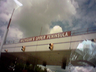
UP at last
Finally the UP!
2000-07-14 12:20:21-05
Location
45°50'48.3"N 84°43'23.9"W
Camera: Eyemodule
Family Reunion 2000
places
Travel
Wandering
18 Pictures nearby
[
-
( Range about 72 Miles )
+ ]
UP at last
0.000 Feet
Mackinac Bridge
0.734 Miles
More Rocks
11.982 Miles
Mushroom 3
11.982 Miles
Mushroom 2
11.982 Miles
View More
There are fourteen pictures within two days.
5 of them are:
Reunion: me
2000-07-15 11:56:44-05
Reunion: cake
2000-07-15 11:55:15-05
Camping: Wells State Park
2000-07-15 08:36:53-05
Camping: neighbors
2000-07-15 08:36:53-05
Camping: kitchen
2000-07-15 08:36:44-05
Full List

 View More