dry lake   
  
dry lake

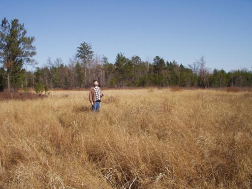
Quite some time ago, when arial photos first started showing up on the web, my dad and I noticed what appeared to be a large lake in an area of woods that we knew pretty well.

After seeing a lake on topographic maps as well (in an area where we were pretty sure we hadn't seen one) we decided to just put the location in a GPS and see what was out there.

This is what we found - a rather large open area, that shows signs of possibly filling with water after a heavy rain. The ground was very dry - it has not seen water in a long time.

2003-04-26 15:45:00-05

   Location   
  
44°6'58.0"N 84°5'36.0"W
MapQuest MultiMap
Topozone Map Mapper of Doom
      
  
Attributes 
cottage
  
places
  
Wandering
  
Camera: D520
  
20 Pictures nearby
[- ( Range about 1 Miles ) + ]

Picture Thumbnail Distance 
dry lake  dry lake   0.000 Feet   
Jackpine  Jackpine   0.341 Miles   
Andy and Dad  Andy and Dad   0.484 Miles   
Hanks Bar  Hanks Bar   0.940 Miles   
Dad on Bridge  Dad on Bridge   1.365 Miles   

View More
There are five pictures within two days.
5 of them are:
Picture Thumbnail Timestamp 
Dam overflow  Dam overflow  2003-04-26 17:25:00-05  
Dam boards  Dam boards  2003-04-26 17:24:00-05  
Dam interior  Dam interior  2003-04-26 17:19:00-05  
Inside the dam  Inside the dam  2003-04-26 17:16:19-05  
dry lake  dry lake  2003-04-26 15:45:00-05  

Full List
click to email