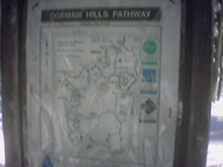
Ogemaw: Map
A map of the trails at
Ogemaw Hills
where I went skiing with my family on New Years Day 2001.
A bigger map is available
here
2001-01-01 12:08:31-05
Location
44°21'1.4"N 84°13'33.1"W
Camera: Eyemodule
relaxing...
snow
17 Pictures nearby
[
-
( Range about 13 Miles )
+ ]
View More
Jackpine
8.983 Miles
dry lake
9.303 Miles
Dad on Bridge
10.639 Miles
Walk in the Woods
11.072 Miles
Walk in the Woods
11.116 Miles
View More
There are nine pictures within two days.
5 of them are:
Wood Burning Stove
2001-01-02 11:16:07-05
Cottage
2001-01-01 15:09:54-05
Cottage: back
2001-01-01 15:08:50-05
Skiing: Father
2001-01-01 12:36:18-05
Ogemaw: Map
2001-01-01 12:08:31-05
Full List

 View More
 View More