Columbia Icefield   
  
Columbia Icefield

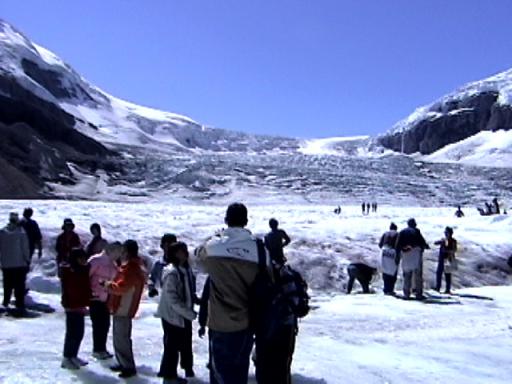
In the background, the Columbia icefield can be seen spilling over the ring of mountains, from it the Athabasca Glacier is fed.
Joy and I rode a Snowcoach out here (rather than risking our lives by walking).

This picture is a frame grab from my digital camcorder - click on it for a larger version.

2001-08-15 14:54:00-05

   Location   
  
52°11'37.5"N 117°15'24.3"W
MapQuest MultiMap
Toporama
      
  
Attributes 
Alberta 2001
  
Camera: DCR TRV-120
  
places
  
Travel
  
snow
  
Wandering
  
20 Pictures nearby
[- ( Range about 42 Miles ) + ]
View More

Picture Thumbnail Distance 
Me @ Switchback  Me @ Switchback   13.938 Miles   
Joy @ Switchback  Joy @ Switchback   13.938 Miles   
Angel Glacier  Angel Glacier   28.647 Miles   
Small Blue Lake  Small Blue Lake   28.857 Miles   
Sunwapta Falls  Sunwapta Falls   29.092 Miles   

View More
There are twentynine pictures within two days.
5 of them are:
Picture Thumbnail Timestamp 
Sunwapta Falls  Sunwapta Falls  2001-08-15 21:29:58-05  
Sunwapta Falls  Sunwapta Falls  2001-08-15 21:26:44-05  
Athabasca Falls upstream  Athabasca Falls upstream  2001-08-15 20:36:18-05  
Athabasca river  Athabasca river  2001-08-15 20:32:09-05  
Athabasca Falls Canyon  Athabasca Falls Canyon  2001-08-15 20:24:33-05  

Full List
click to email