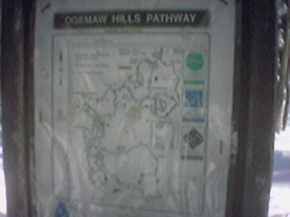
Ogemaw: Map
A map of the trails at
Ogemaw Hills
where I went skiing with my family on New Years Day 2001.
A bigger map is available
here
2001-01-01 12:08:31-05
Location
44°21'1.4"N 84°13'33.1"W
Camera: Eyemodule
relaxing...
snow
33 Pictures nearby
[
-
( Range about 23 Miles )
+ ]
View More
Dugout Canoe
11.498 Miles
Wood Burning Stove
11.536 Miles
Woodpile
11.541 Miles
Cottage
11.541 Miles
Cottage: back
11.541 Miles
View More
There are nine pictures within two days.
5 of them are:
Wood Burning Stove
2001-01-02 11:16:07-05
Cottage
2001-01-01 15:09:54-05
Cottage: back
2001-01-01 15:08:50-05
Skiing: Father
2001-01-01 12:36:18-05
Ogemaw: Map
2001-01-01 12:08:31-05
Full List

 View More
 View More