Mackinac Bridge
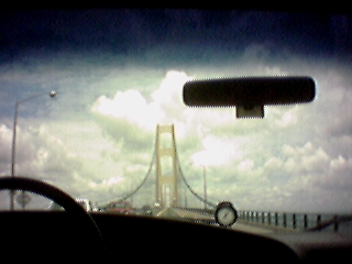
A picture of the Mackinac bridge, through the
windshield of the van as we approach it from the south.
There is a live image of the bridge available
here
.
2000-07-14 12:17:22-05
Location
45°47'19.5"N 84°43'57.0"W
Camera: Eyemodule
Family Reunion 2000
places
Travel
Wandering
27 Pictures nearby
[
-
( Range about 85 Miles )
+ ]
View More
Agawa Bay: Tent
12.646 Miles
More Rocks
12.662 Miles
Mushroom 3
12.662 Miles
Mushroom 2
12.662 Miles
Mushroom
12.662 Miles
View More
There are fourteen pictures within two days.
5 of them are:
Reunion: me
2000-07-15 11:56:44-05
Reunion: cake
2000-07-15 11:55:15-05
Camping: Wells State Park
2000-07-15 08:36:53-05
Camping: neighbors
2000-07-15 08:36:53-05
Camping: kitchen
2000-07-15 08:36:44-05
Full List

 View More
 View More