Costal Highway
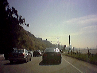
This is part of the Costal Highway, by Santa Monica.
Traffic was a little heavy, but not bad at all.
The beaches were completely empty - I guess it was still rather early in the season.
2001-03-13 12:58:08-05
Location
34°1'24.4"N 118°30'37.5"W
Camera: Eyemodule
places
Travel
Wandering
LA 2001
20 Pictures nearby
[
-
( Range about 12 Miles )
+ ]
View More
Century Blvd
8.855 Miles
Frys
8.880 Miles
LA: night
8.963 Miles
Hotel
8.963 Miles
LA: Day
8.963 Miles
View More
There are eight pictures within two days.
5 of them are:
Frys
2001-03-13 13:45:31-05
Cliff Dwelings
2001-03-13 13:34:51-05
Costal Highway
2001-03-13 12:58:08-05
Hollywood Sign
2001-03-13 12:02:00-05
LA: night
2001-03-12 23:01:02-05
Full List

 View More
 View More